Recent Projects
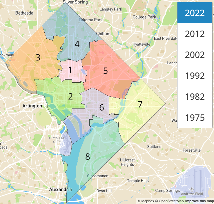
Washington, D.C. Ward Boundaries Over Time
24 Sep 2022
This map shows how Washington, D.C.’s ward boundaries have changed over time. Ward data retrieved from Open Data DC catalog.
Live version located at: DC Wards.
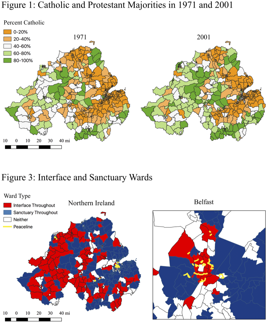
Segregation and the Spatial Distribution of Violence in the Northern Ireland Conflict
10 Aug 2018
My Master’s thesis explores the relationship between changing social demographics, ethno-religious segregation, and interpersonal violence during The Troubles conflict (1960-1998). This project was awarded the Morton A. Kaplan Prize for best Honors thesis.
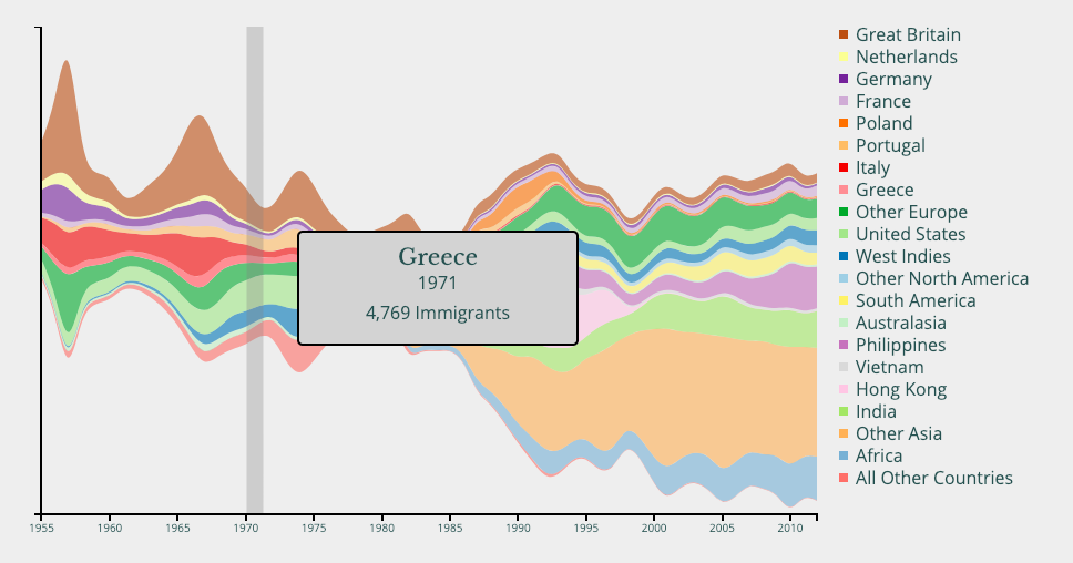
Canadian Immigration
11 May 2018
This project visualizes immigration to Canada over the past 75 years by nation of origin.
Live version located at: Canadian Immigration
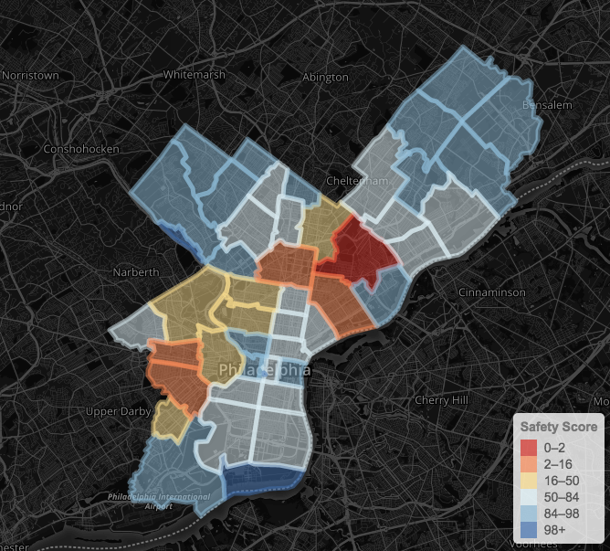
Philly Crime
11 Jan 2017
This visualization explores crime in Philadelphia over the past 30 days. This is a work in progress.
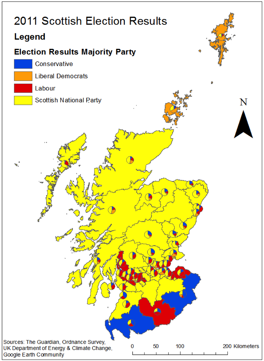
2011 Scottish Holyrood Election
20 Dec 2012
An analysis of the 2011 election for the devolved Scottish parliament. The project explores the impact of geographic distance from natural resource deposits on voting patterns.
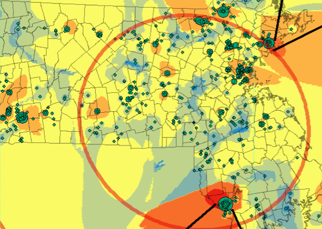
Massachusetts Contamination Concentration, 2010
20 Dec 2012
A spatial analysis of chemical releases across Massachusetts in 2010. The map shows both total releases into the environment and inverse distances from these releases.